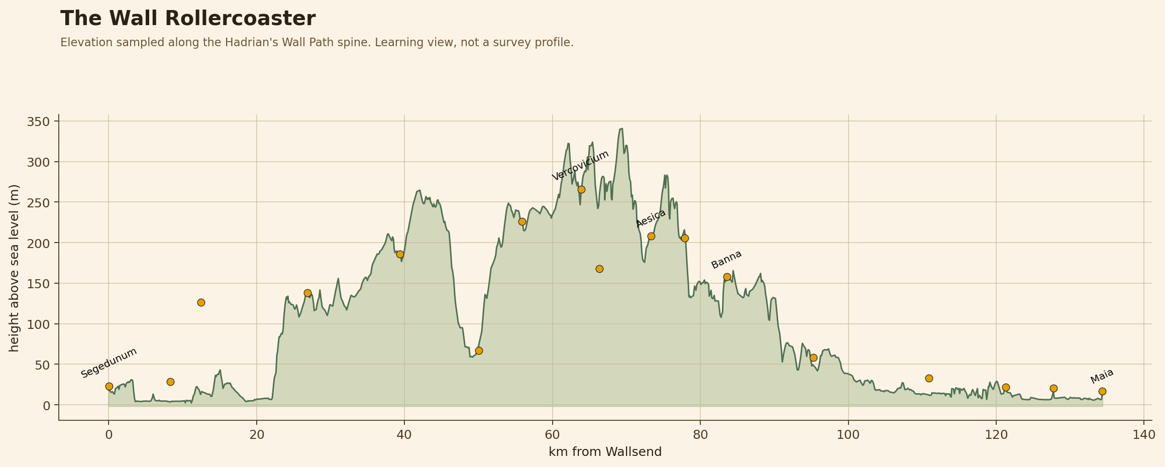
The Wall Rollercoaster
Route elevation from Wallsend to Bowness, with key forts marked.
A kid-friendly terrain lab for Hadrian's Wall: real 1 m ground data, fort footprints, route profiles, drainage puzzles, sightline experiments and engineering challenges.
Route elevation from Wallsend to Bowness, with key forts marked.
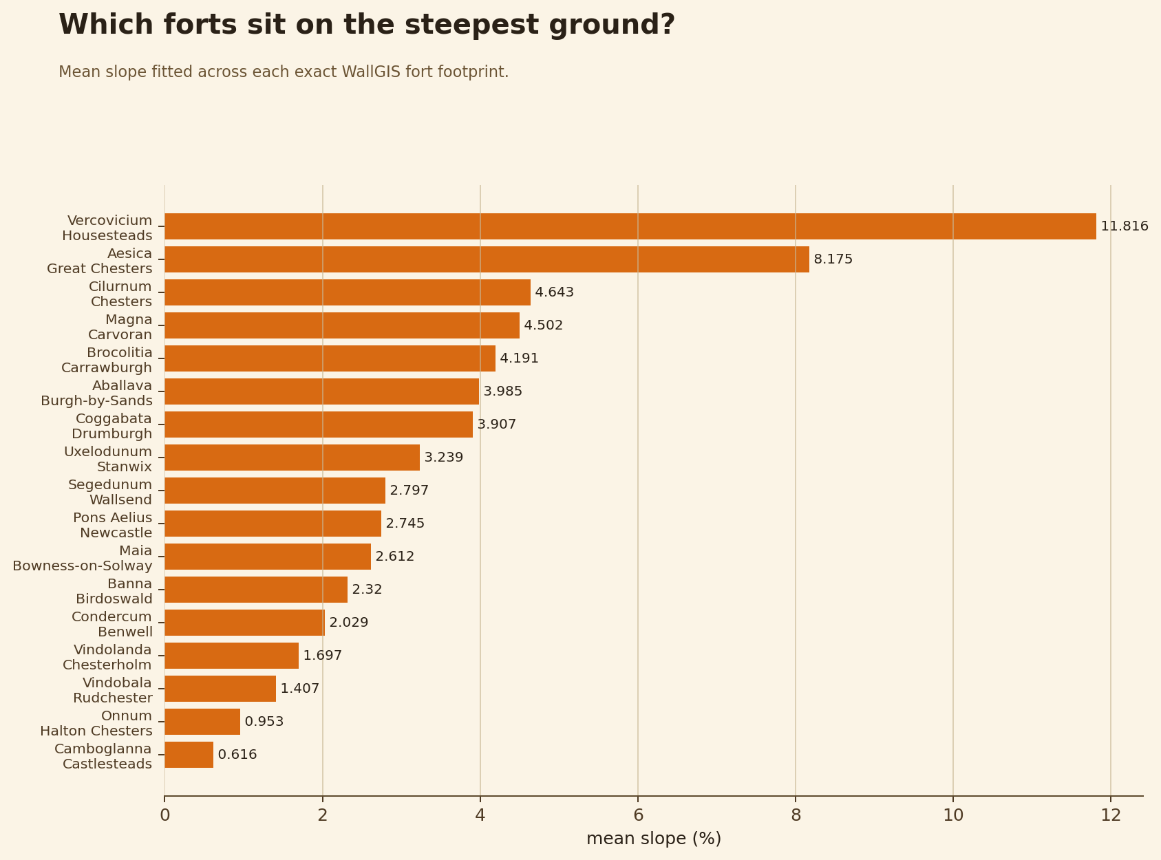
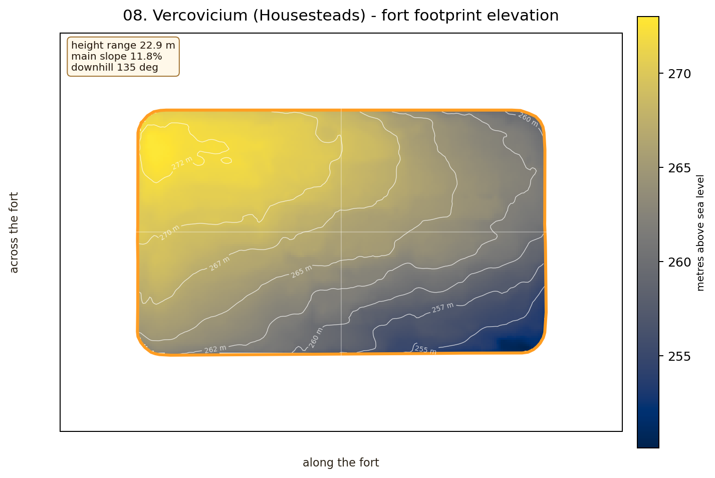
A rank chart: kids can instantly see Housesteads is the hard one.
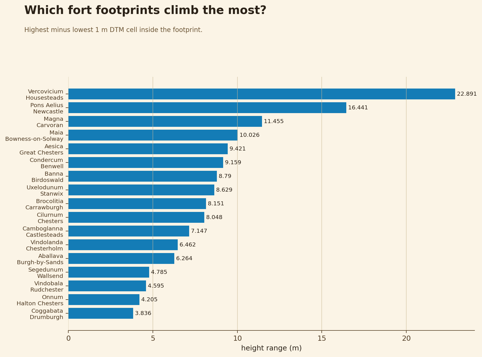
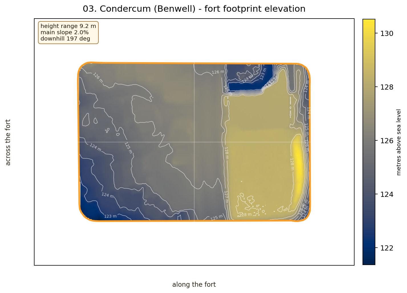
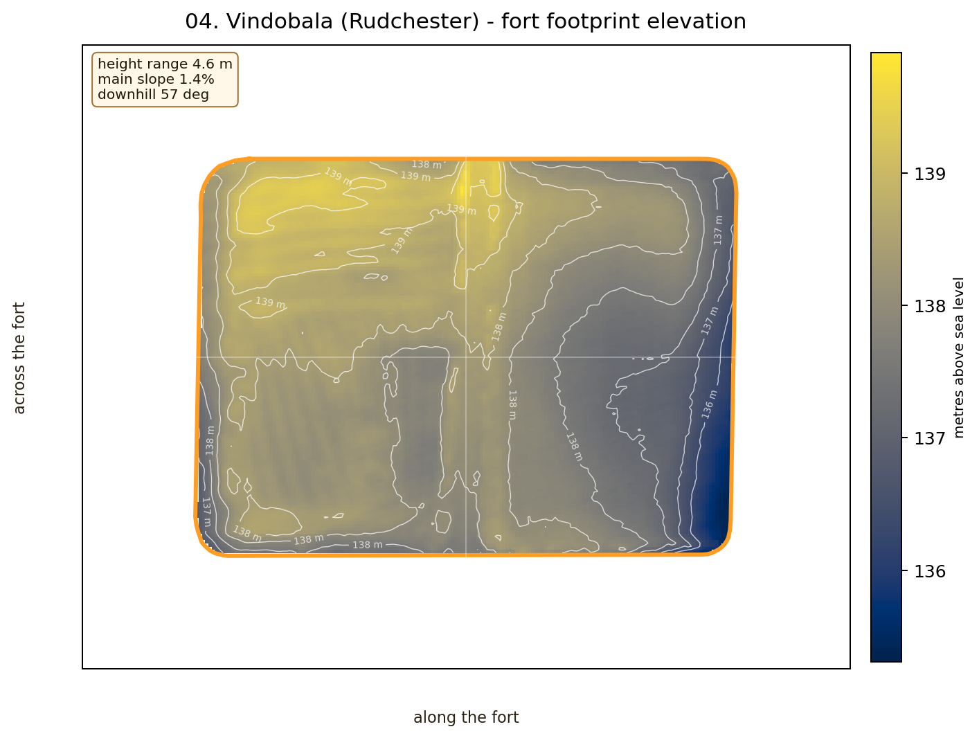
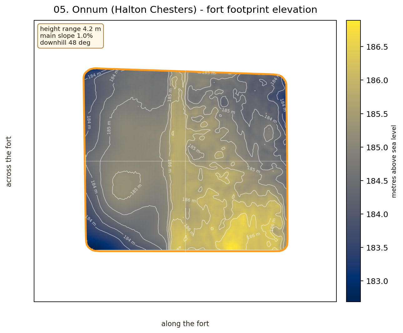
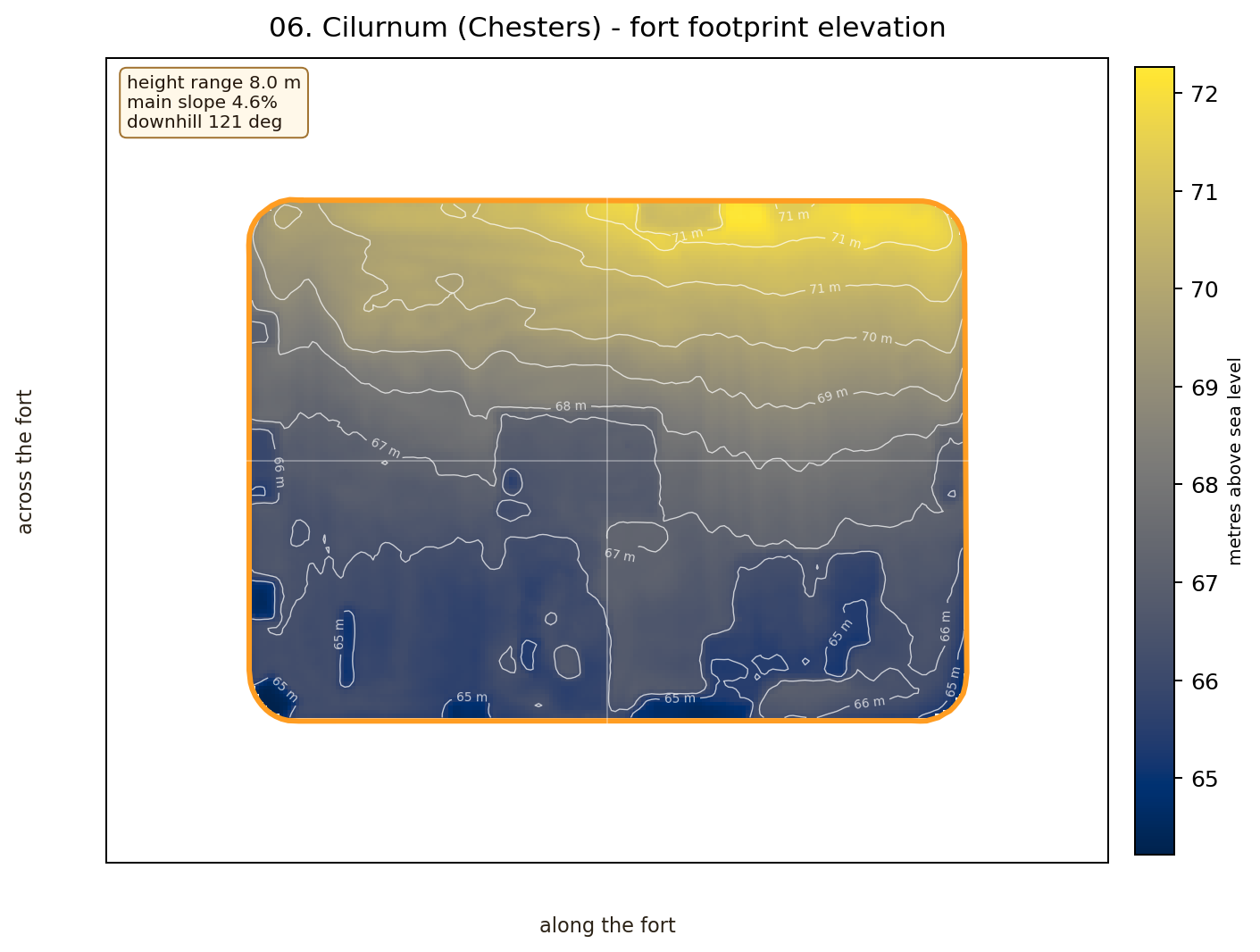
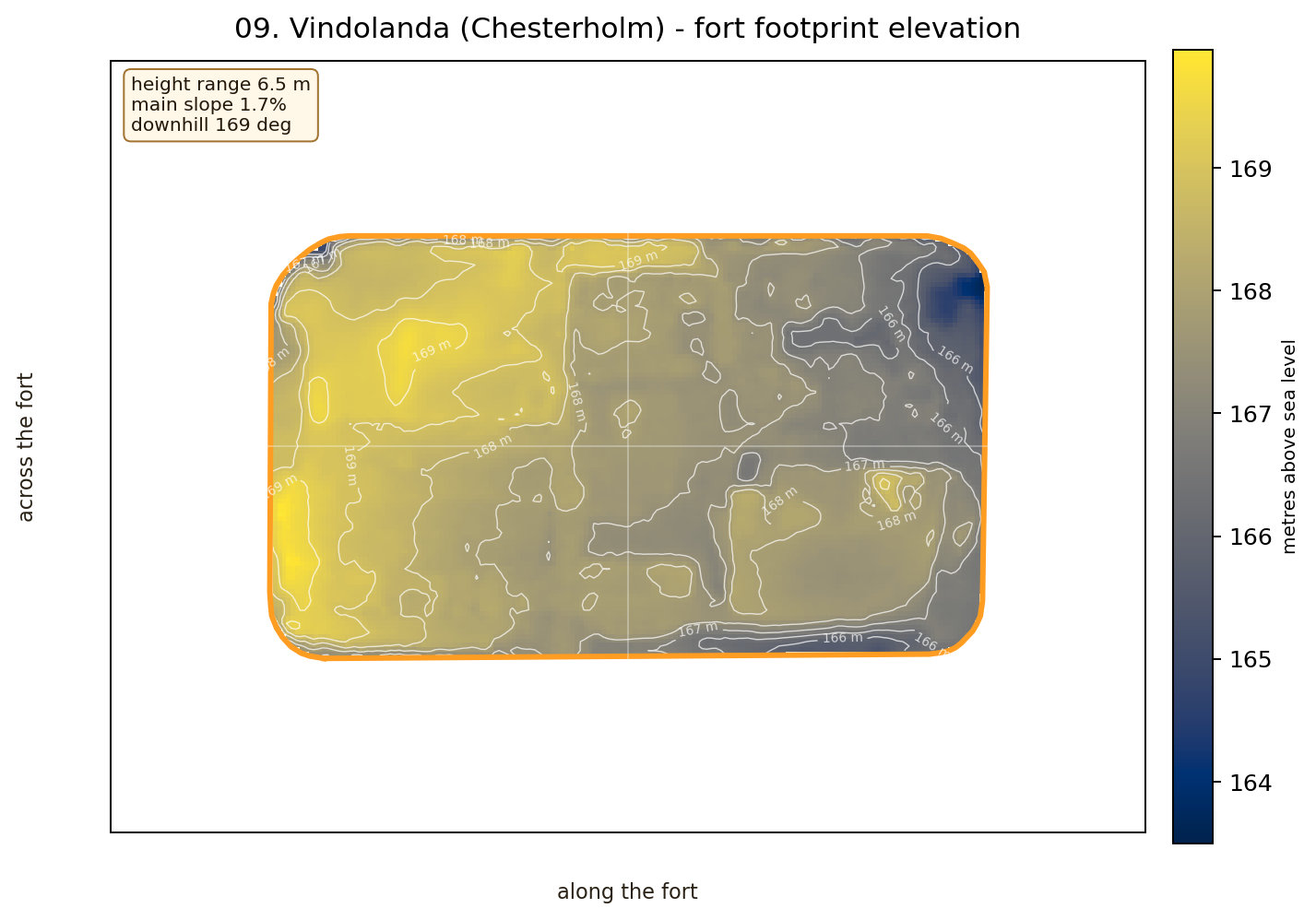
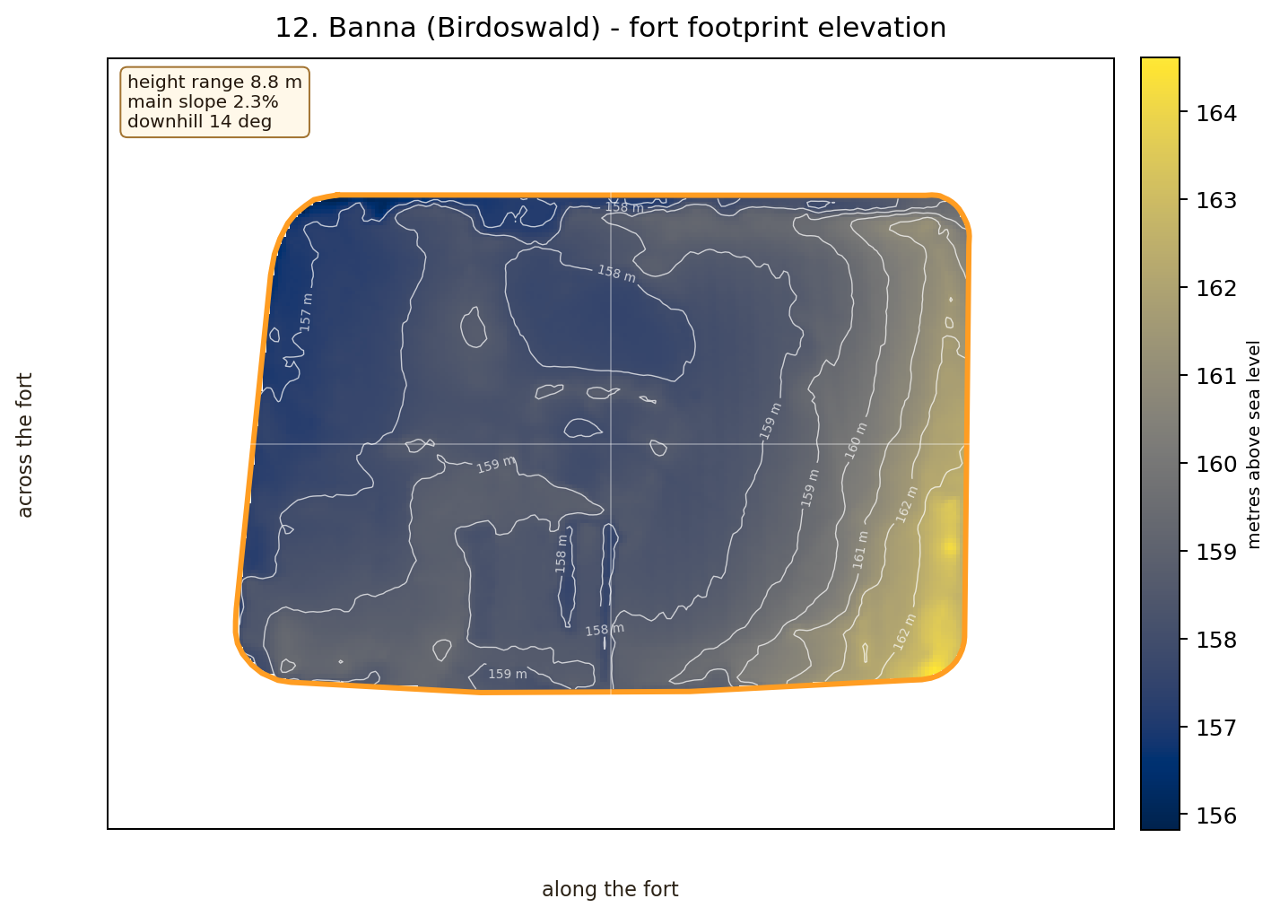
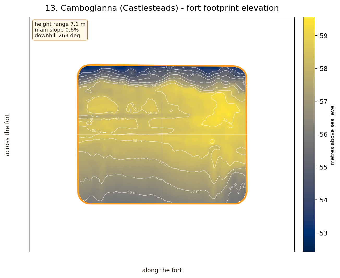
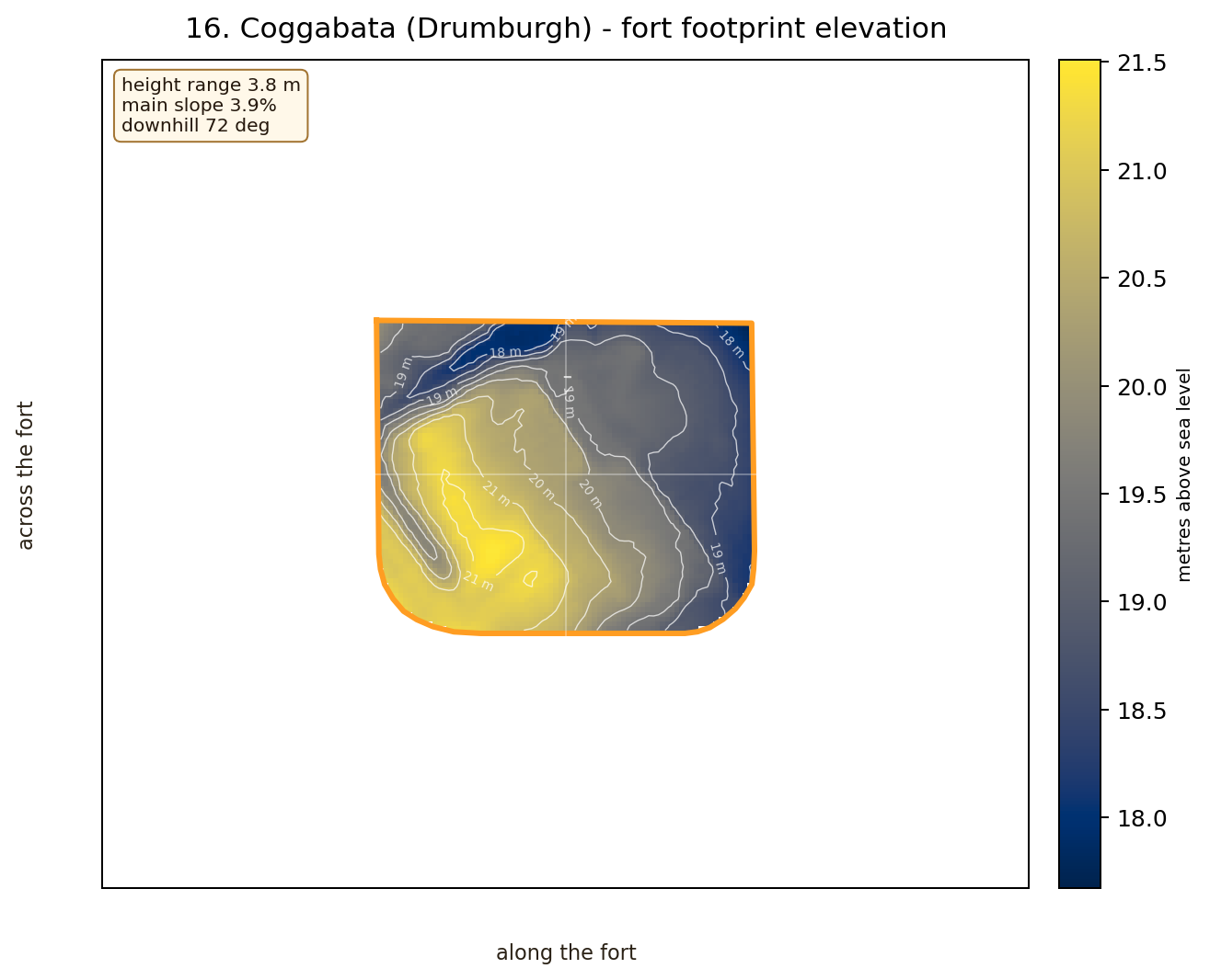
Which fort footprints climb most from low side to high side.
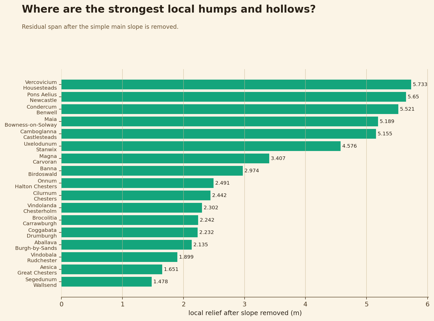
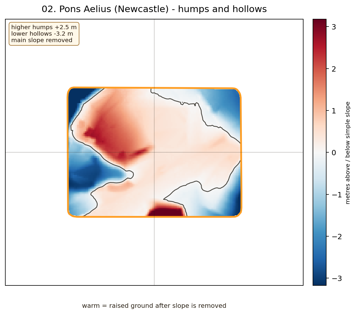
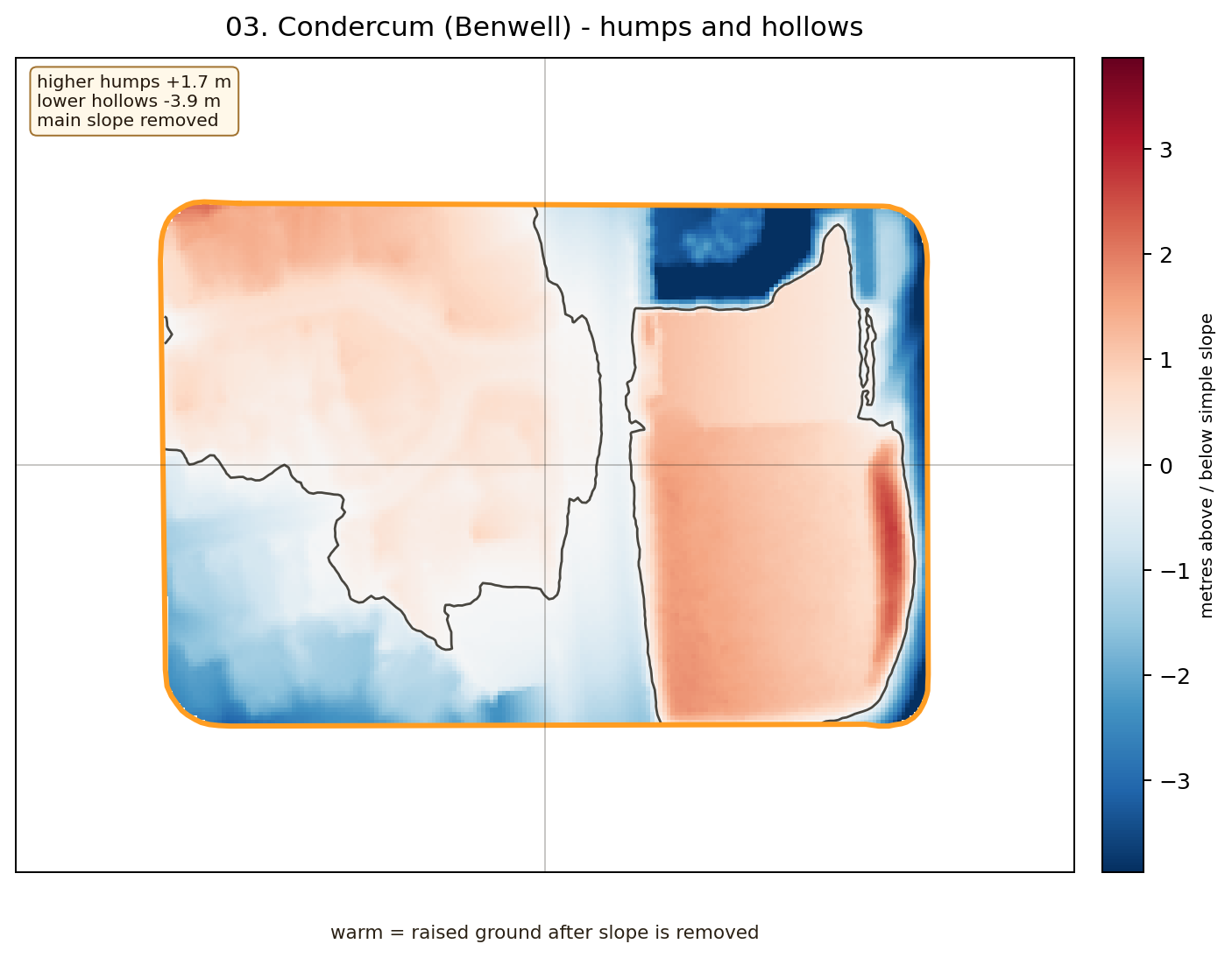
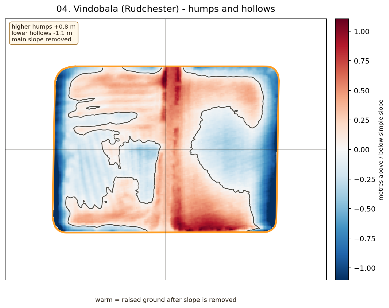
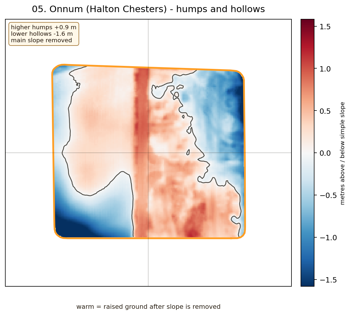
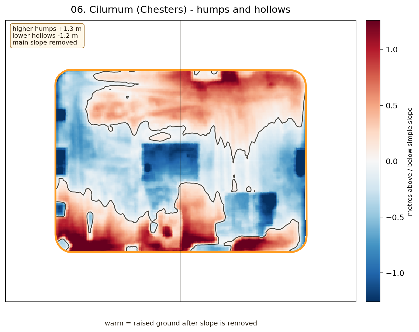
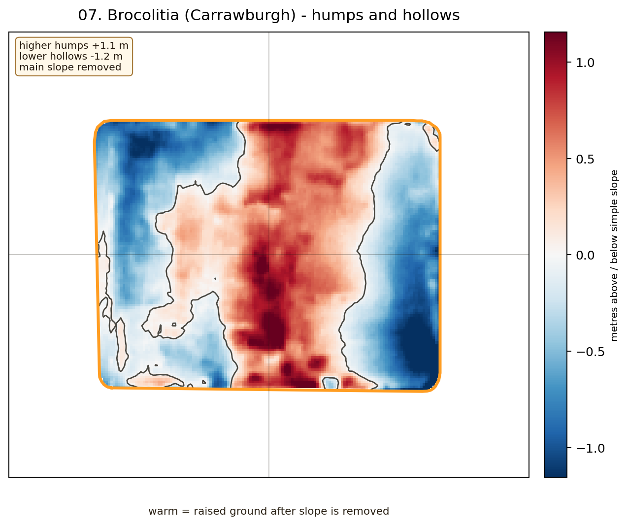
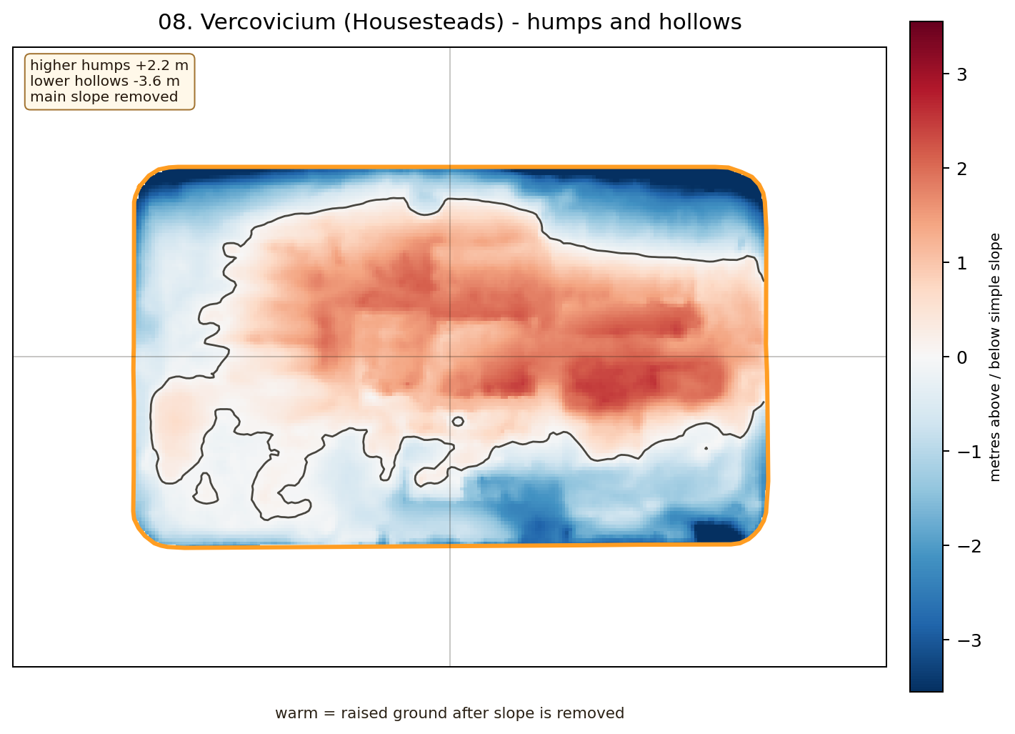
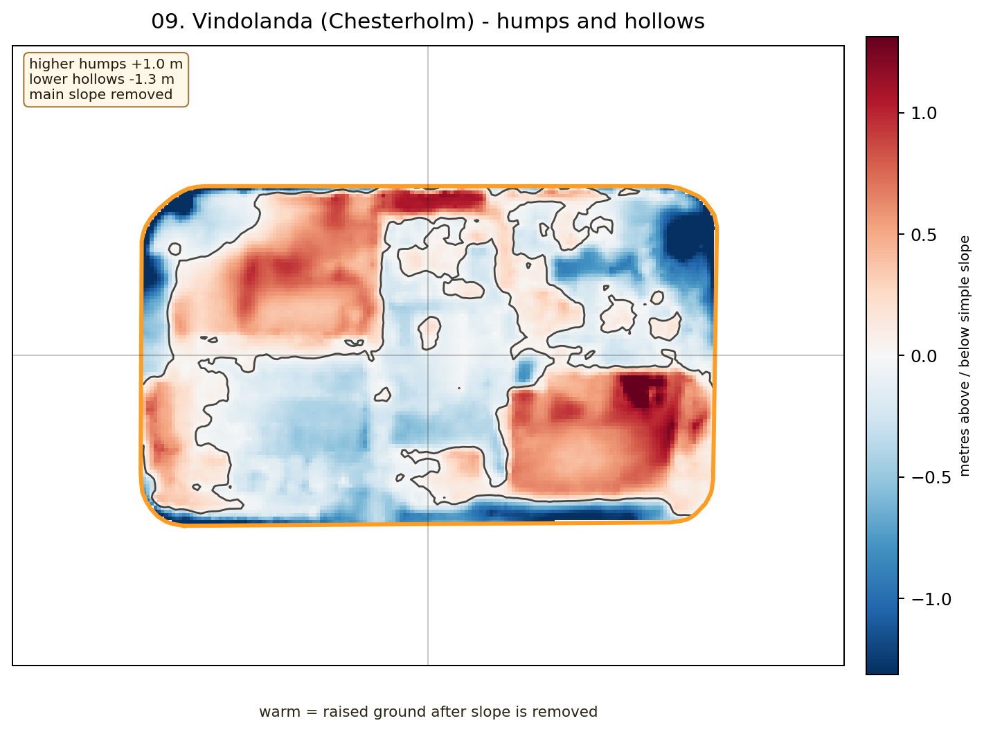
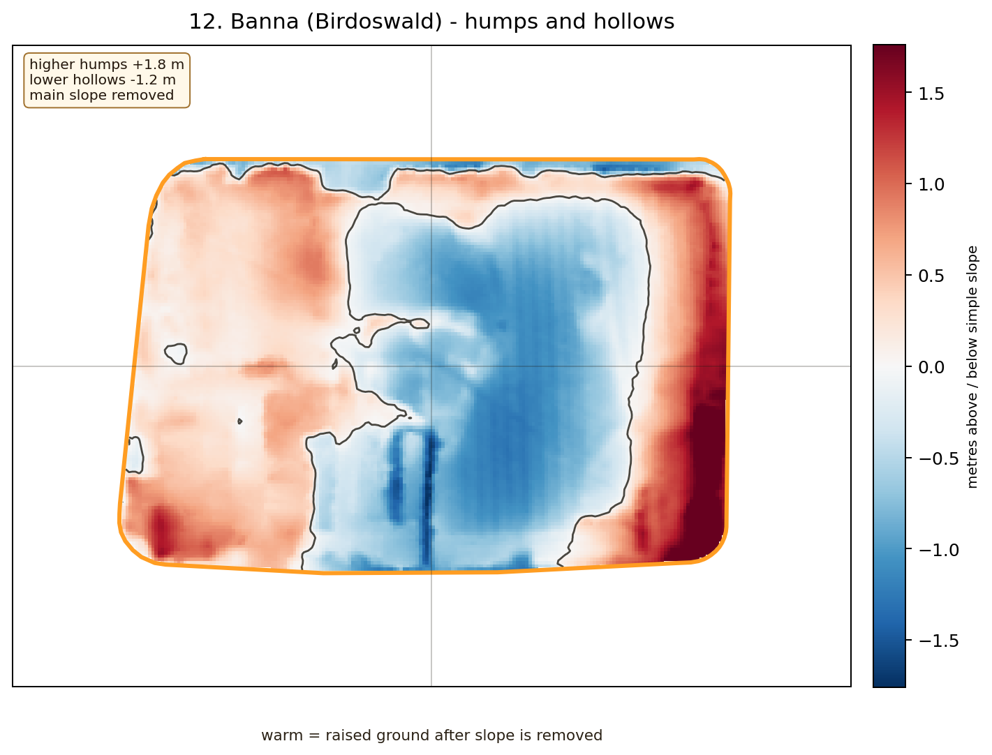
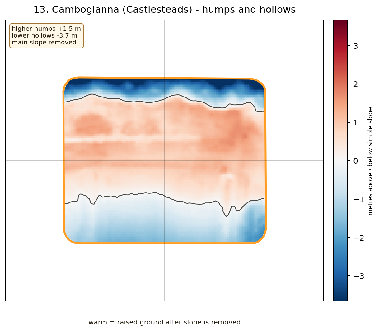
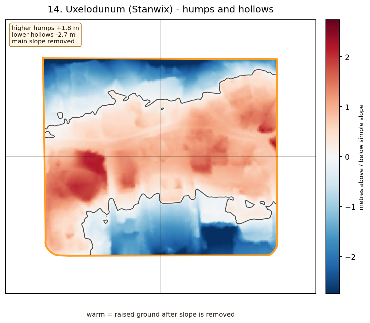
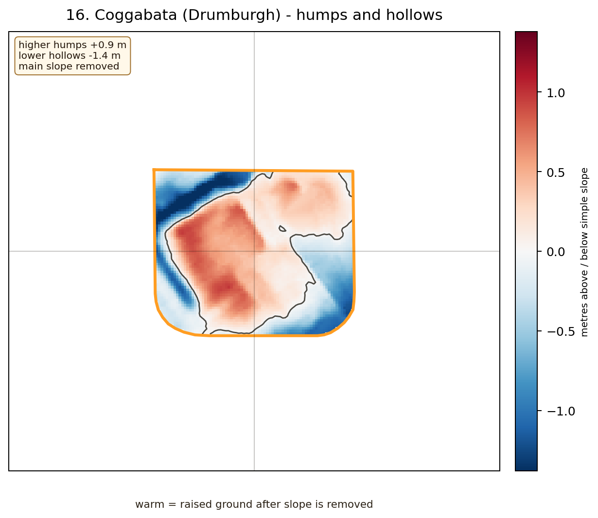
Where local ground shapes remain after the main slope is stripped away.
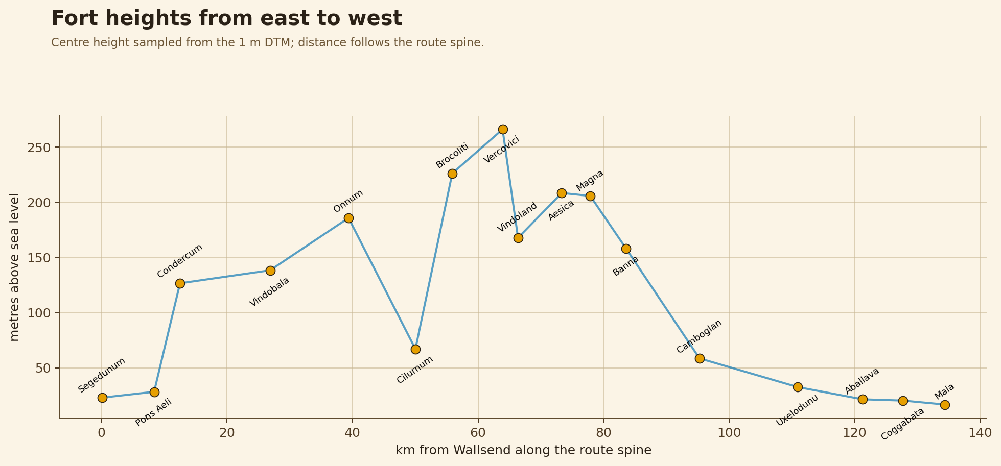
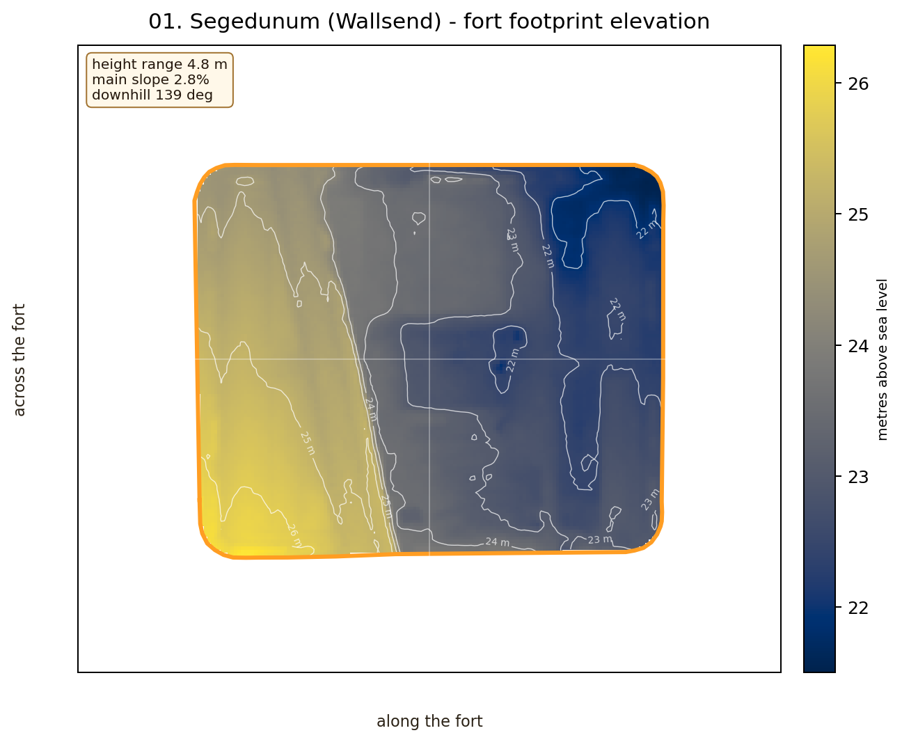
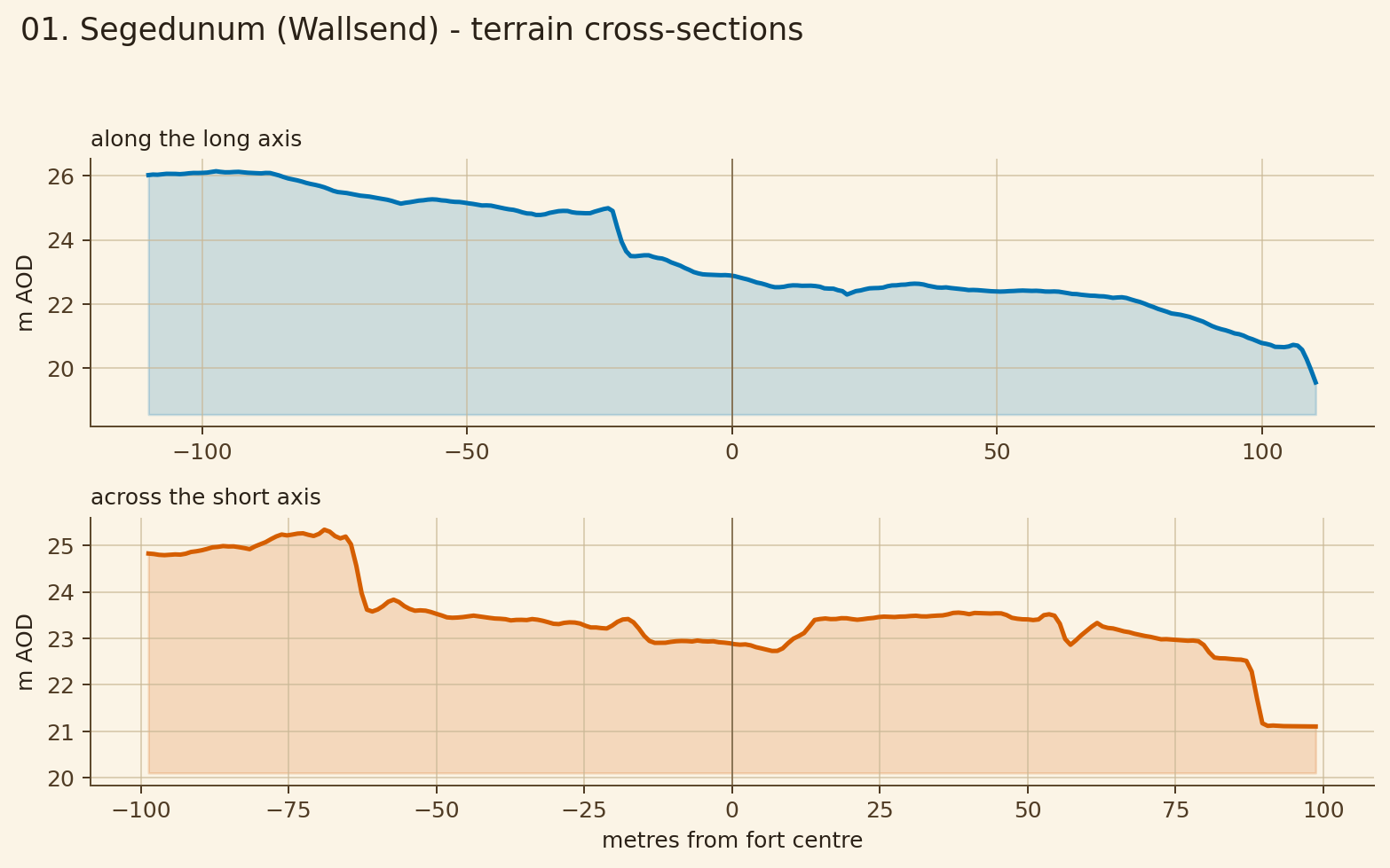
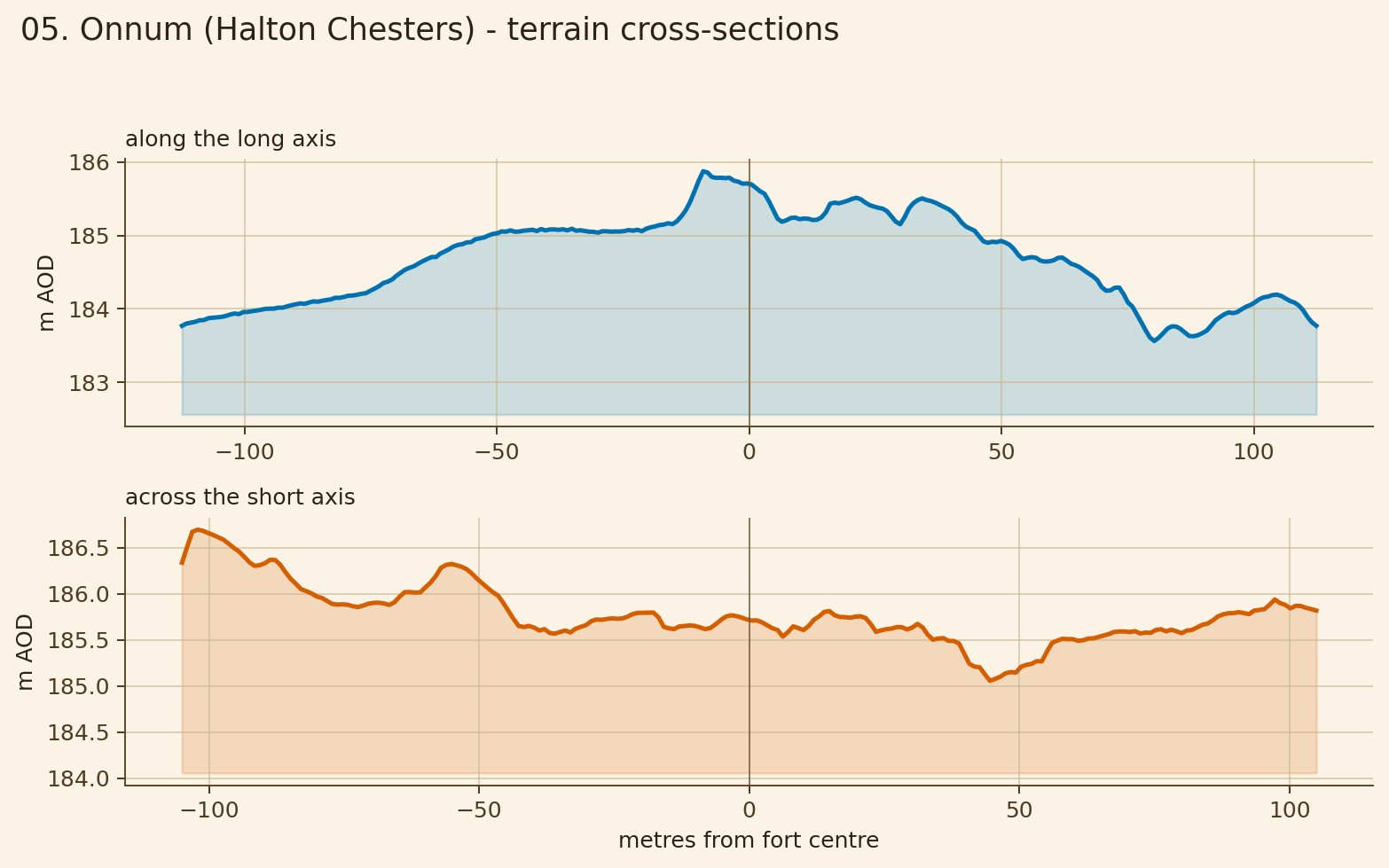
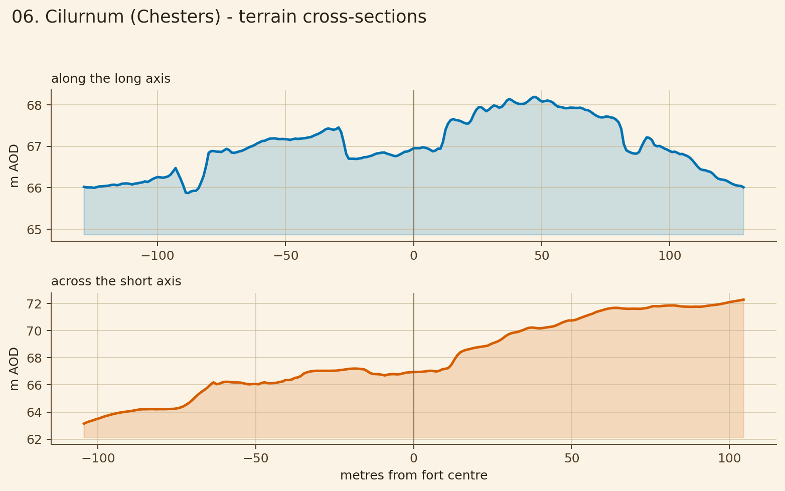
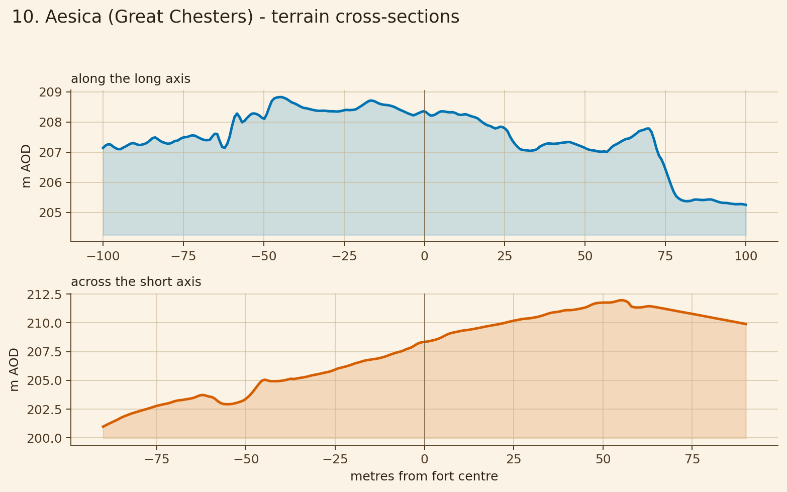
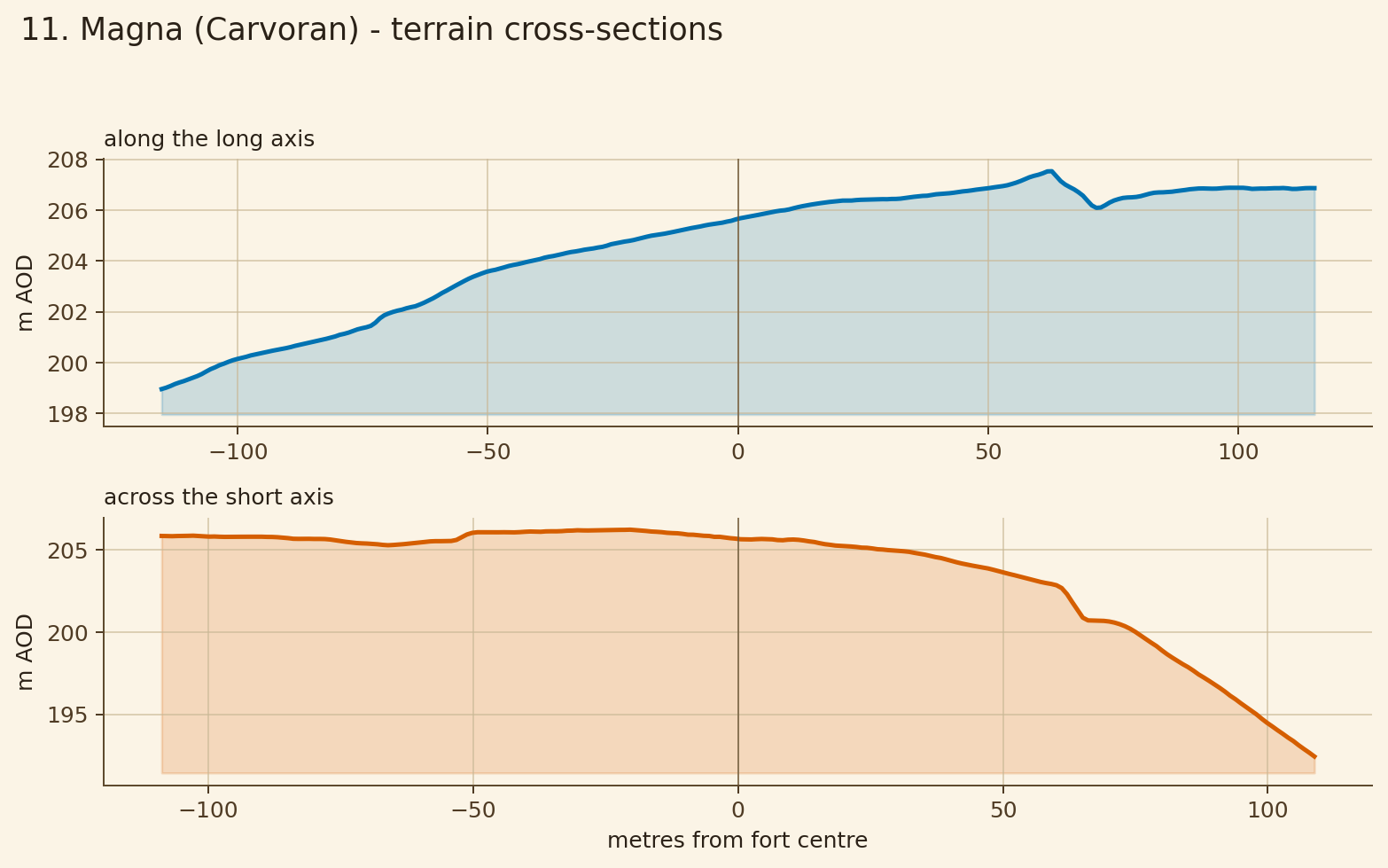
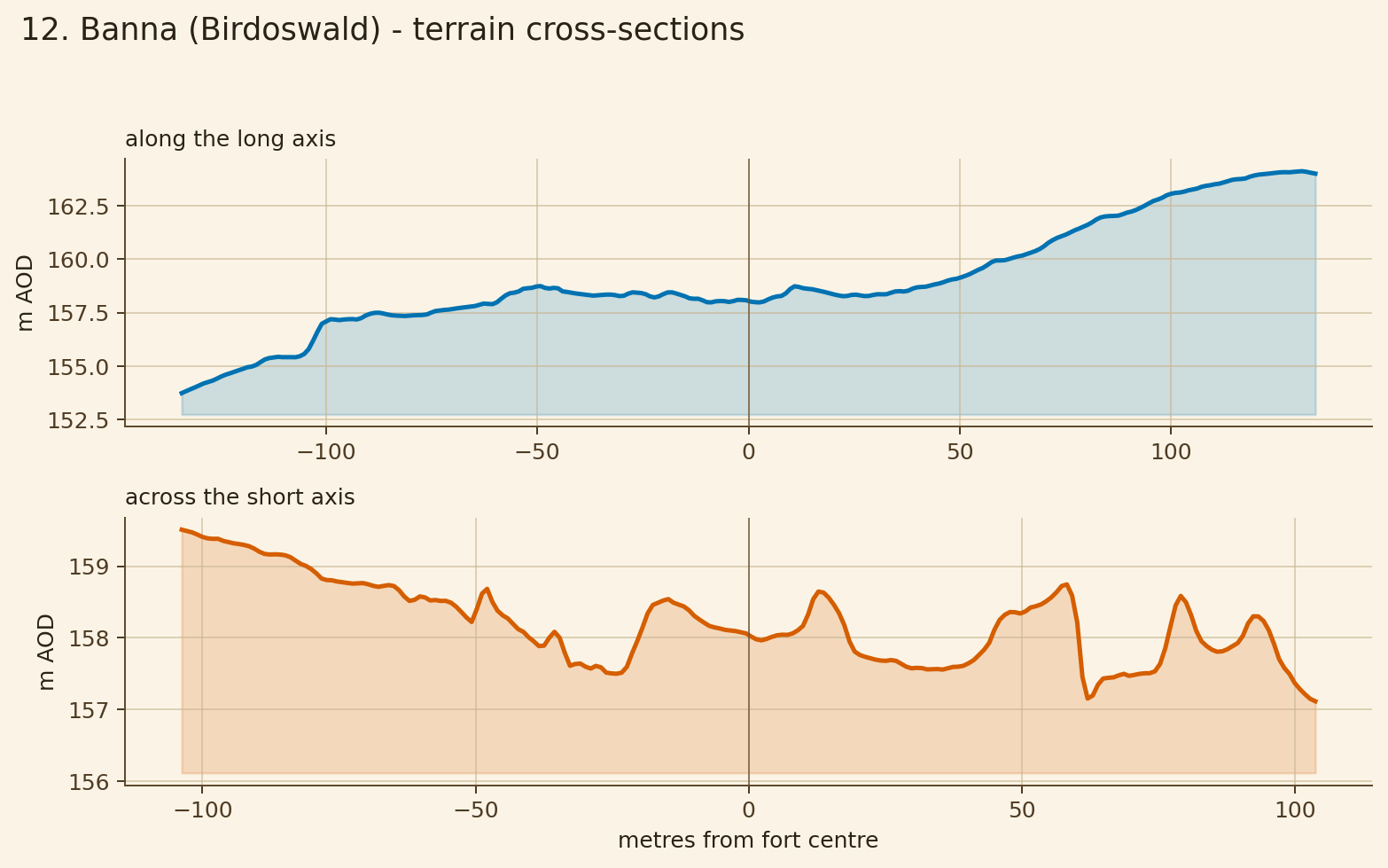
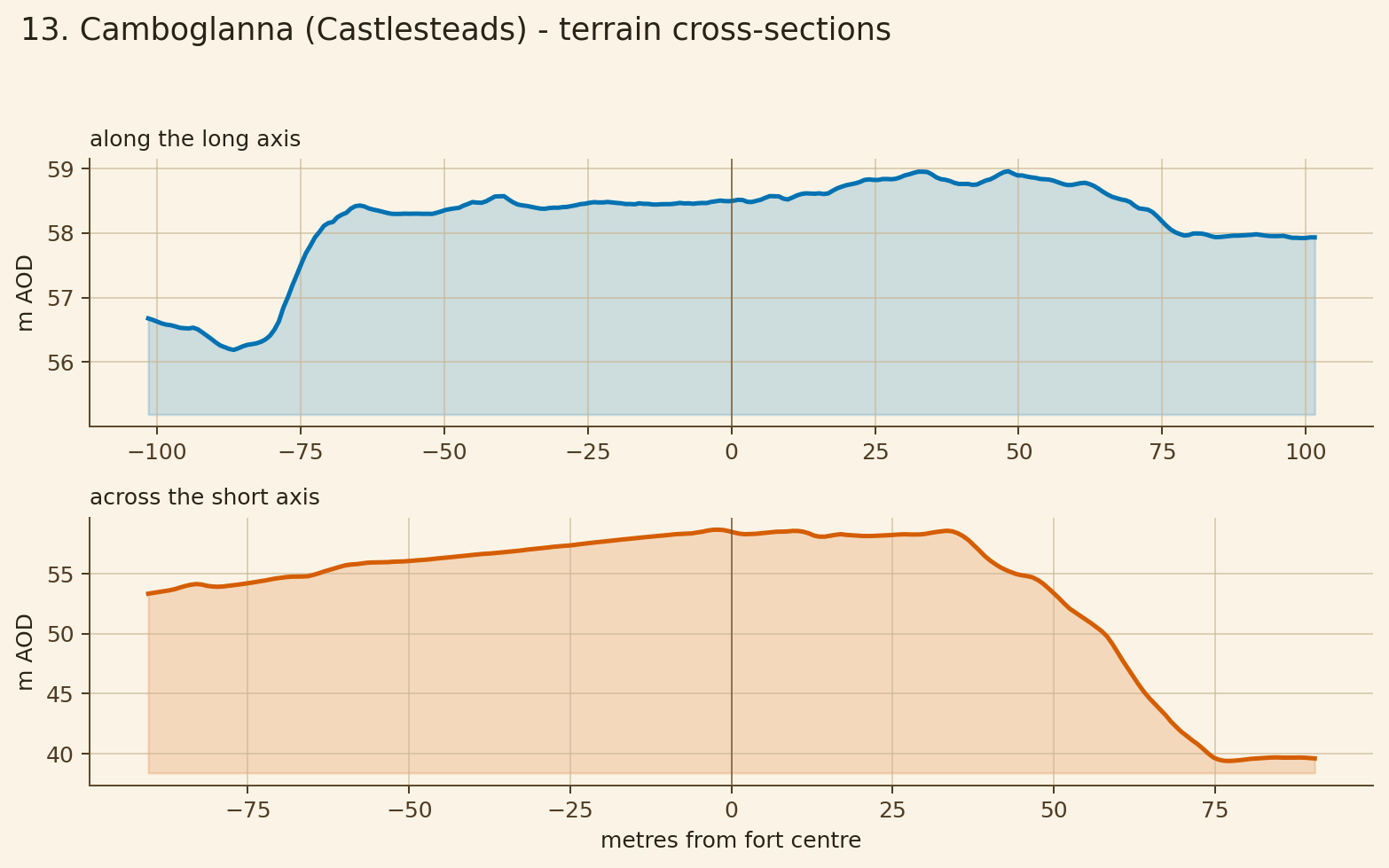
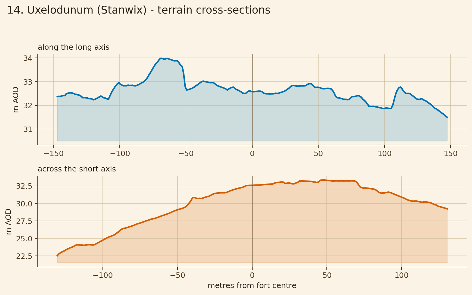
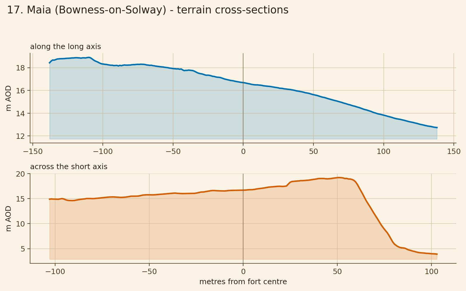
Fort centre heights along the walk.
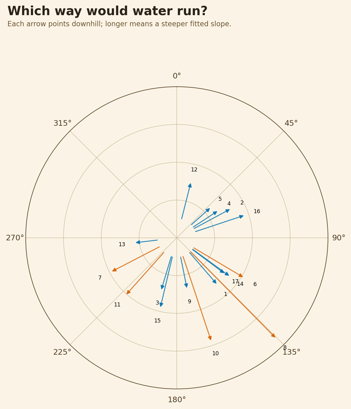
Downhill bearings as a compass puzzle.
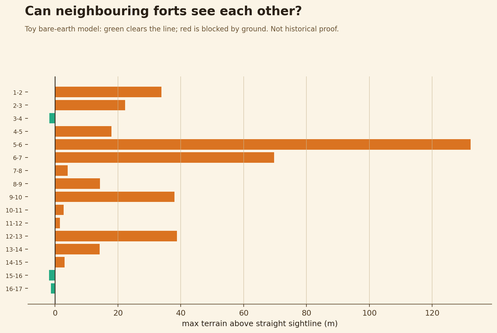
A simple terrain-only visibility test between neighbouring forts.
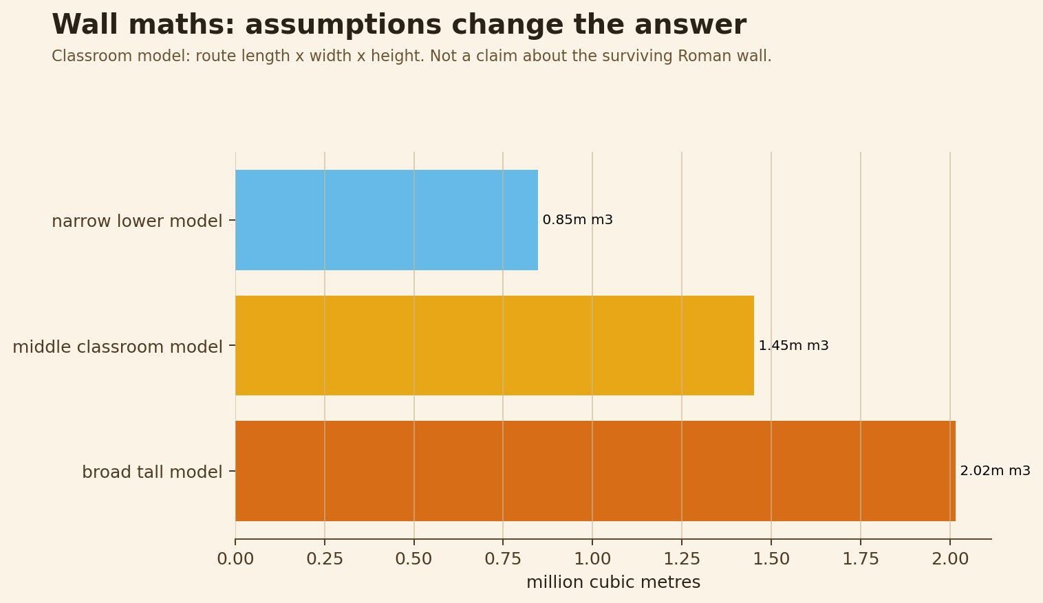
How much stone changes when width/height assumptions change.
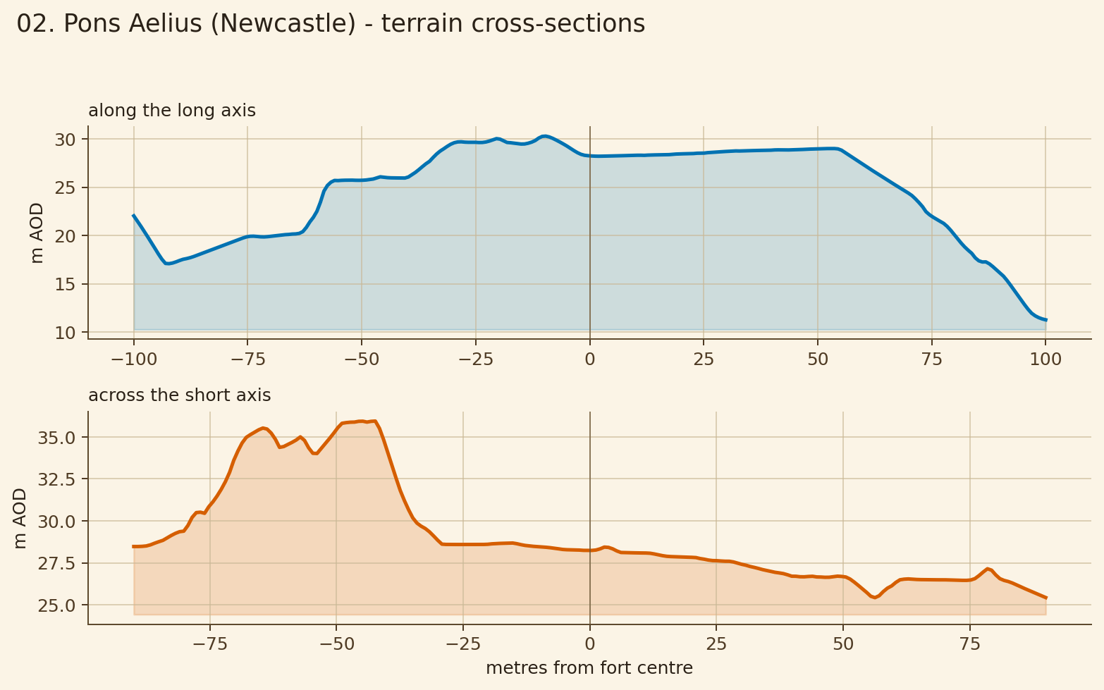
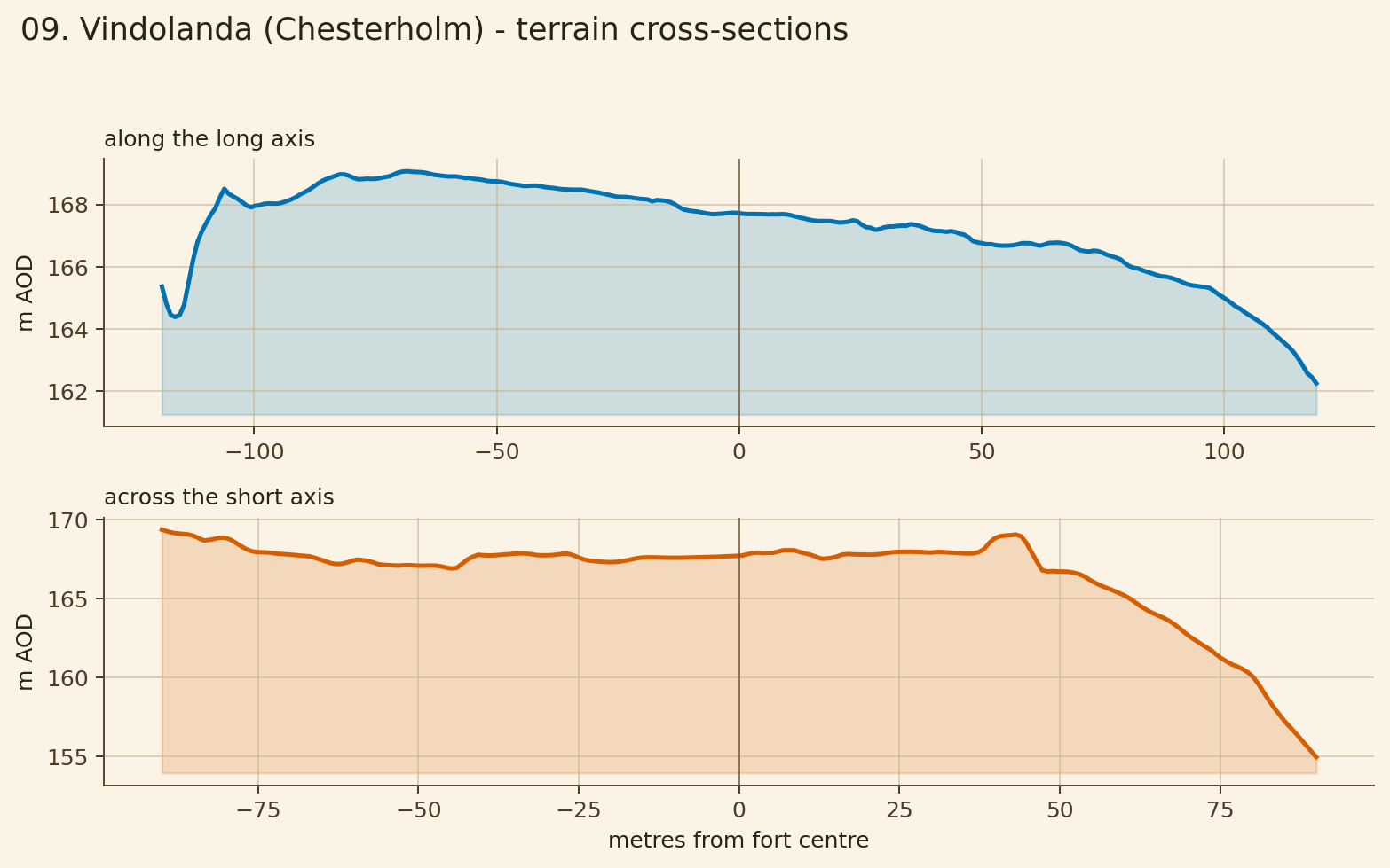
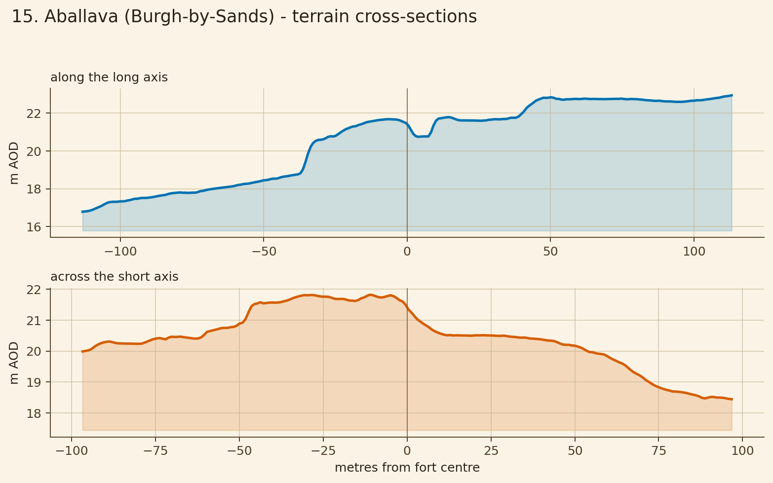
Each card links to the elevation map, humps-and-hollows map and cross-section profile.
gentler working platform
Challenge: Why might an engineer like this quieter piece of ground?
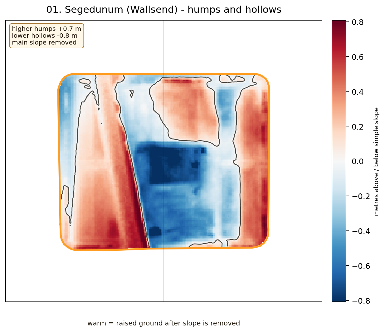
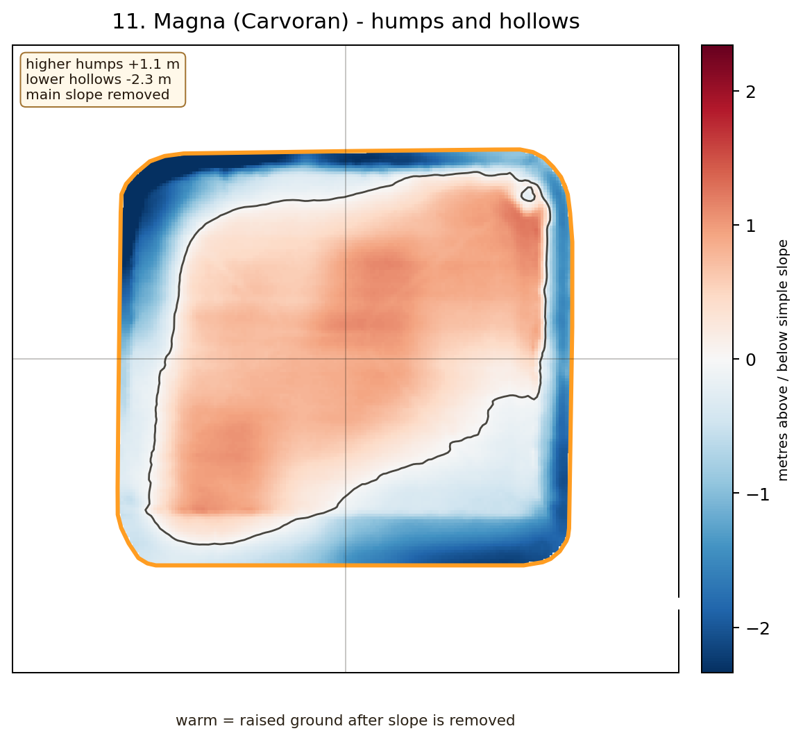
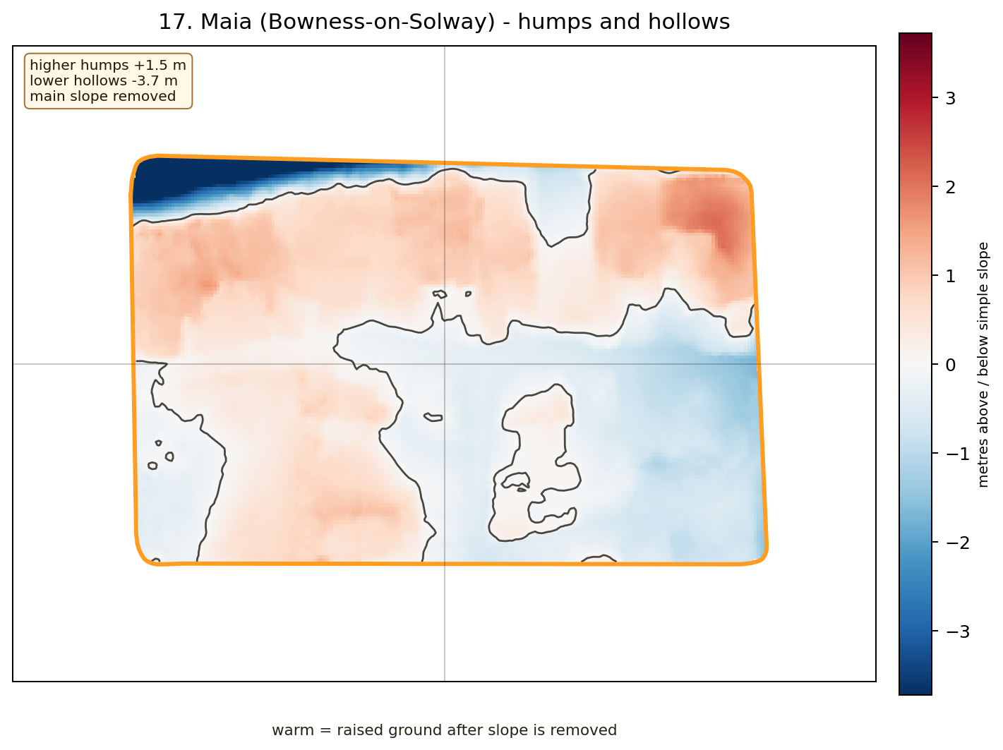
humps-and-hollows detective case
Challenge: Which bumps might be older earthworks, later damage, or real Roman platforms?
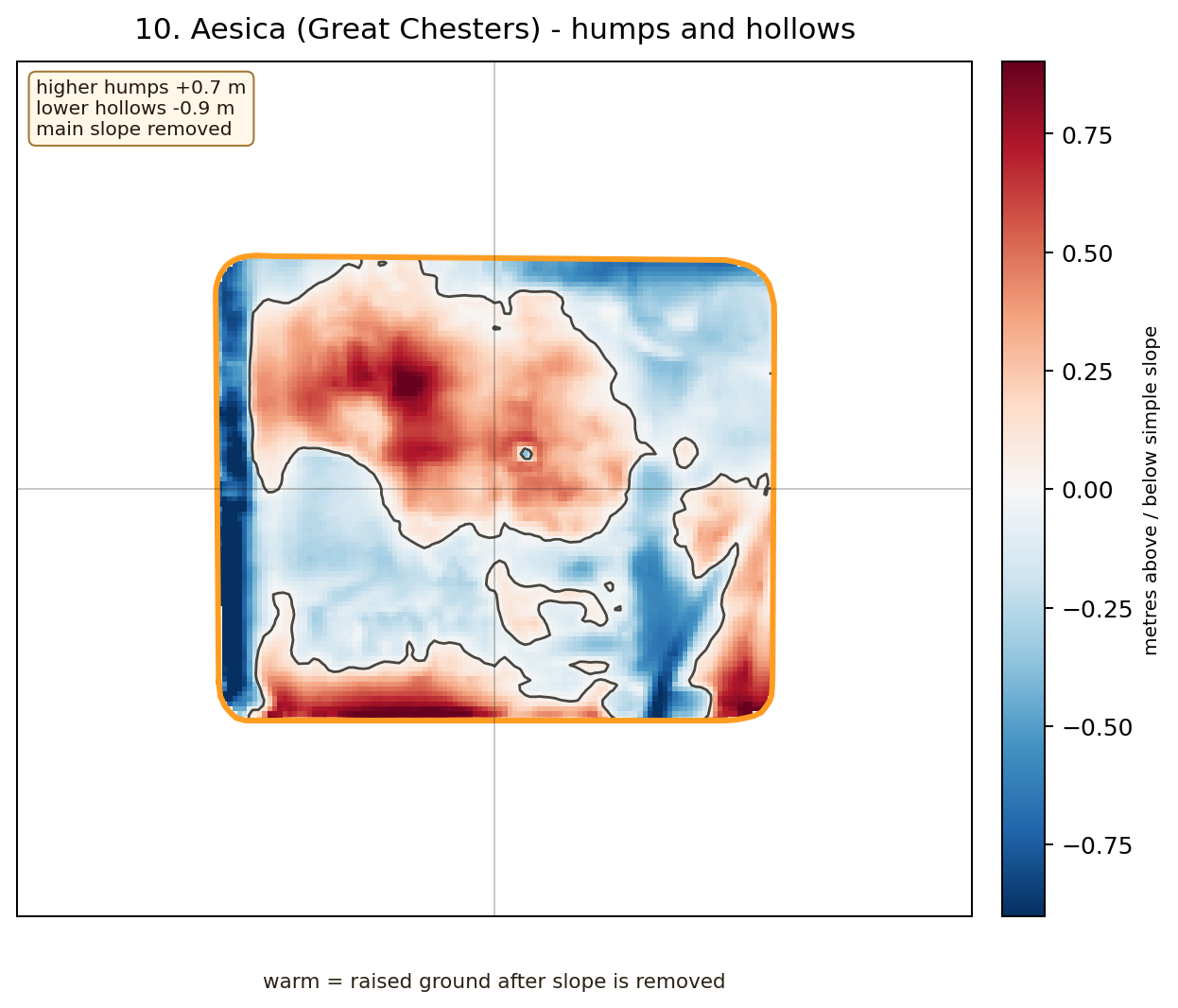
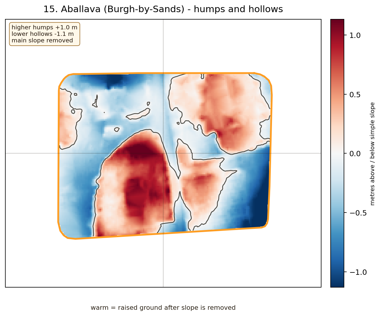
humps-and-hollows detective case
Challenge: Which bumps might be older earthworks, later damage, or real Roman platforms?
gentler working platform
Challenge: Why might an engineer like this quieter piece of ground?
gentler working platform
Challenge: Why might an engineer like this quieter piece of ground?
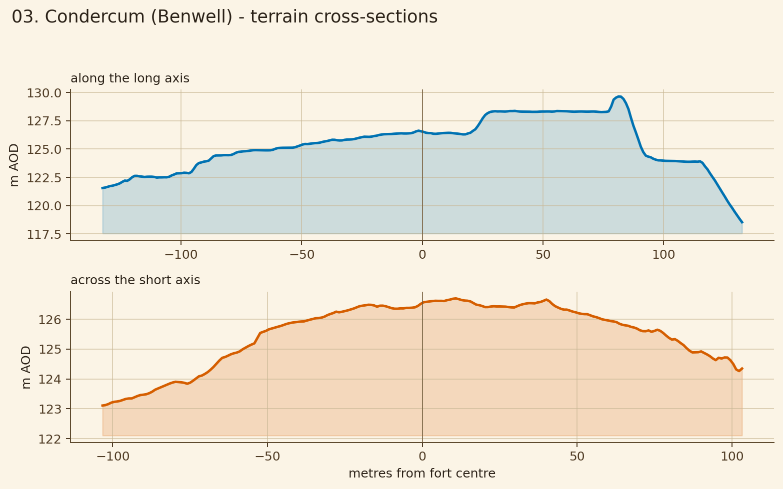
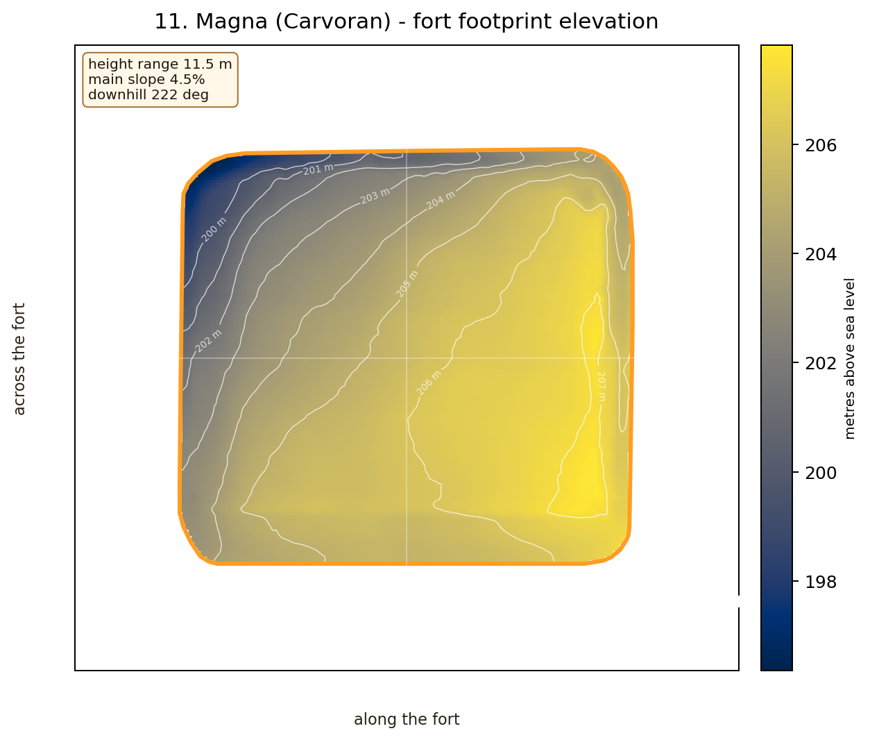
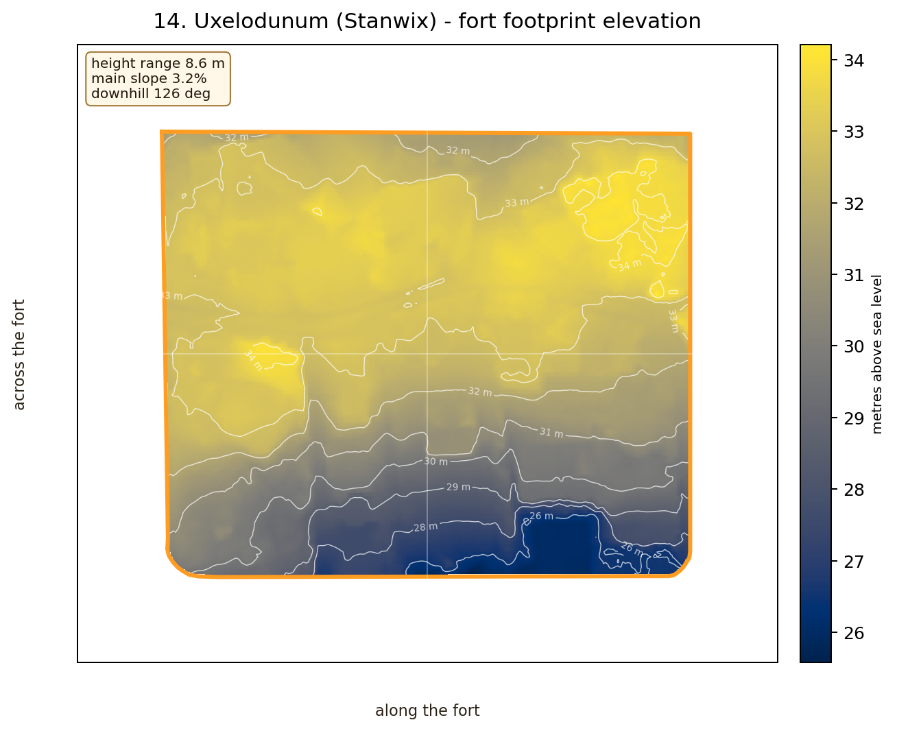
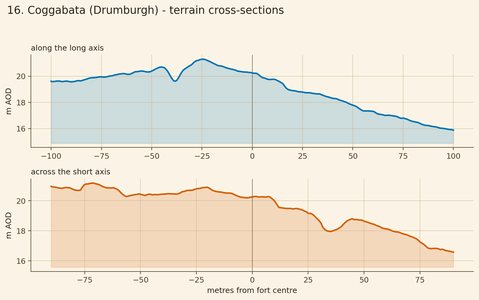
tilted platform
Challenge: Which gate or street would need the cleverest drain?
tilted platform
Challenge: Which gate or street would need the cleverest drain?


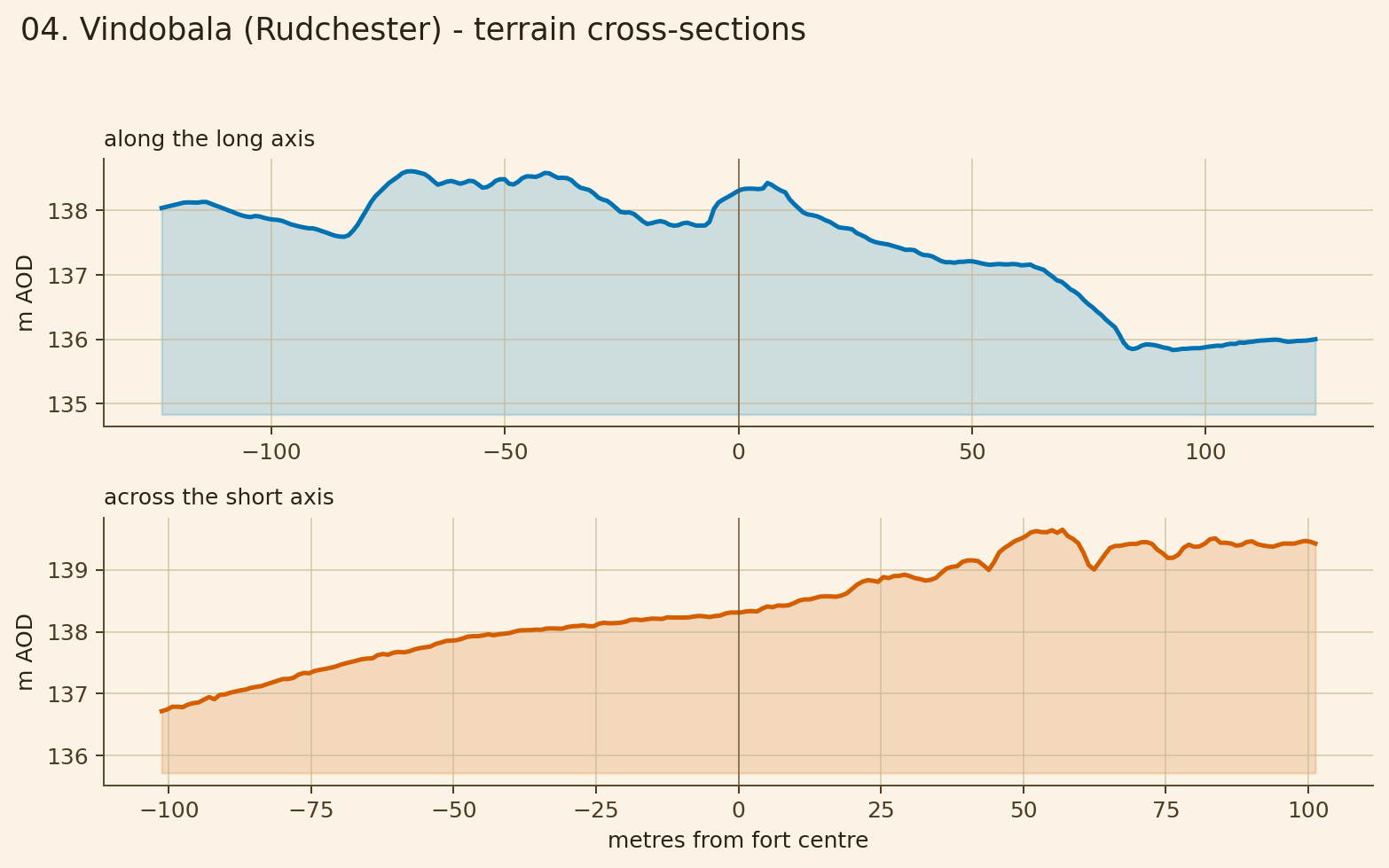
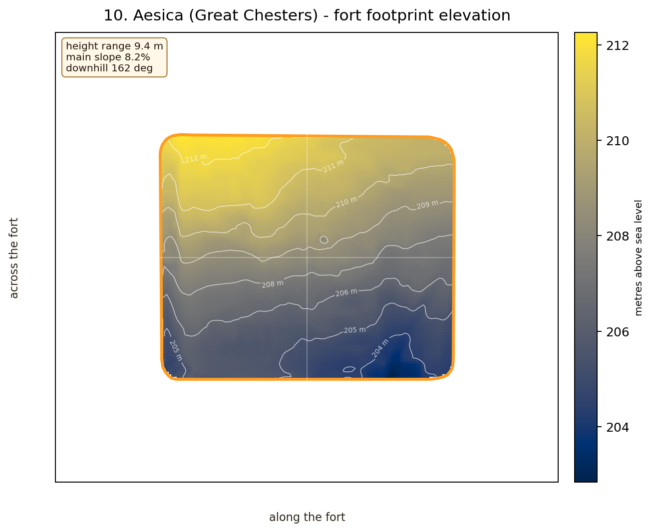
steep hillside fort
Challenge: How would you stop rainwater running straight through the streets?

gentler working platform
Challenge: Why might an engineer like this quieter piece of ground?
steep hillside fort
Challenge: How would you stop rainwater running straight through the streets?
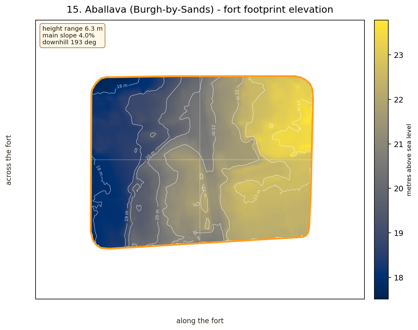
tilted platform
Challenge: Which gate or street would need the cleverest drain?
gentler working platform
Challenge: Why might an engineer like this quieter piece of ground?
gentler working platform
Challenge: Why might an engineer like this quieter piece of ground?
gentler working platform
Challenge: Why might an engineer like this quieter piece of ground?
gentler working platform
Challenge: Why might an engineer like this quieter piece of ground?
gentler working platform
Challenge: Why might an engineer like this quieter piece of ground?
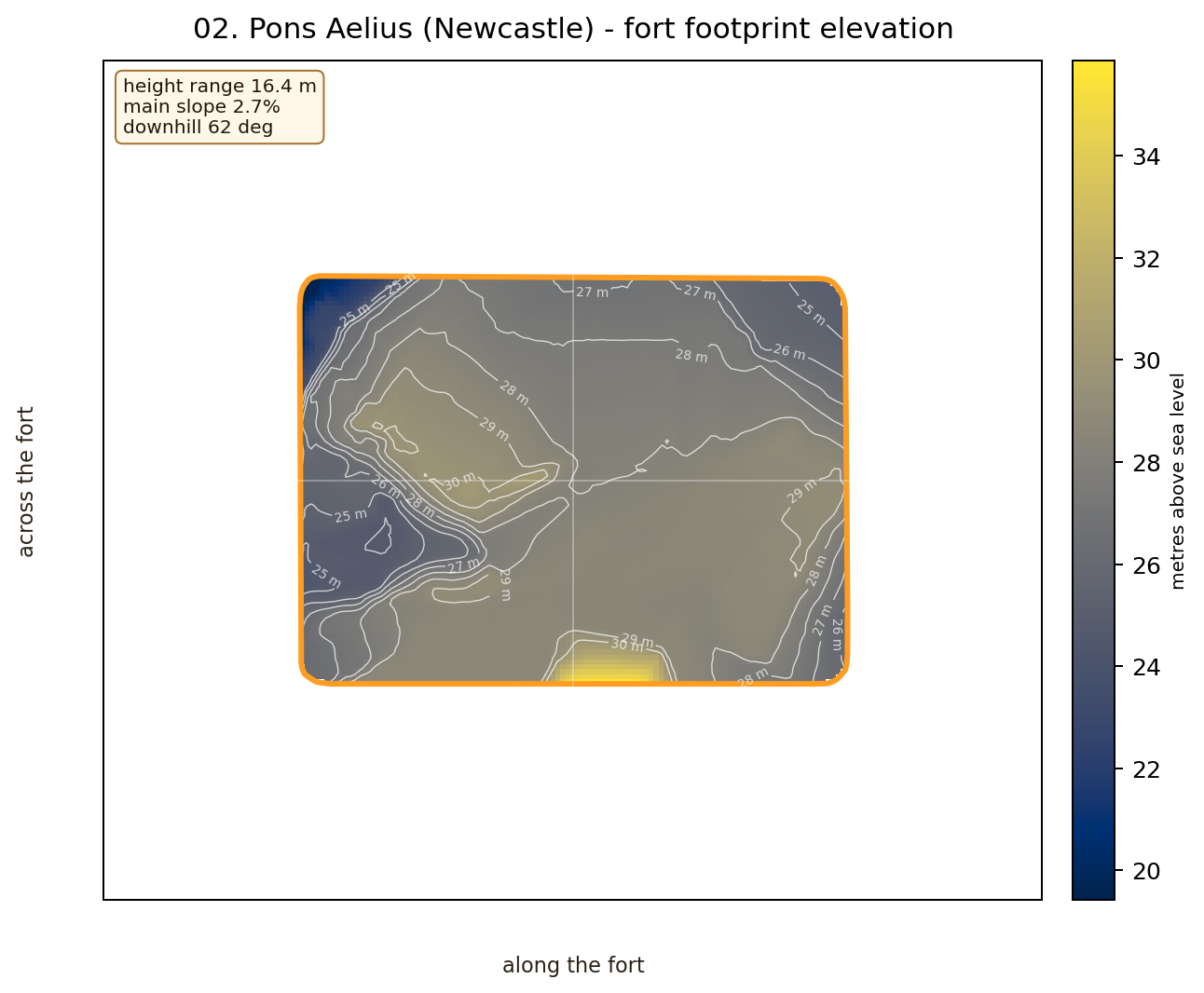
big height-change site
Challenge: Why choose this raised ground instead of somewhere flatter nearby?

Give a child one fort card and ask them to be the Roman surveyor: where would the main street go, where should water drain, and why might this site have been chosen?
This is deliberately labelled as a toy bare-earth model: it ignores towers, buildings, trees, weather and exact signal stations. It is useful as a question-generator, not a proof.
| Pair | Distance | Model result | Worst blockage |
|---|---|---|---|
| Segedunum to Pons Aelius | 5.441 km | blocked | 33.884 m |
| Pons Aelius to Condercum | 3.526 km | blocked | 22.345 m |
| Condercum to Vindobala | 10.725 km | clear | -1.833 m |
| Vindobala to Onnum | 11.561 km | blocked | 17.989 m |
| Onnum to Cilurnum | 8.727 km | blocked | 132.219 m |
| Cilurnum to Brocolitia | 5.362 km | blocked | 69.669 m |
| Brocolitia to Vercovicium | 7.328 km | blocked | 4.075 m |
| Vercovicium to Vindolanda | 3.116 km | blocked | 14.284 m |
| Vindolanda to Aesica | 6.692 km | blocked | 38.014 m |
| Aesica to Magna | 3.977 km | blocked | 2.78 m |
| Magna to Banna | 5.025 km | blocked | 1.516 m |
| Banna to Camboglanna | 10.703 km | blocked | 38.764 m |
| Camboglanna to Uxelodunum | 12.758 km | blocked | 14.221 m |
| Uxelodunum to Aballava | 7.61 km | blocked | 3.023 m |
| Aballava to Coggabata | 6.409 km | clear | -1.93 m |
| Coggabata to Maia | 5.044 km | clear | -1.256 m |
A classroom rectangular-prism model only. It shows why assumptions matter before anyone starts quoting volumes as historical truth.
| Scenario | Width | Height | Volume | Stone mass model |
|---|---|---|---|---|
| narrow lower model | 1.8 m | 3.5 m | 846,468 m3 | 1,946,876 t |
| middle classroom model | 2.4 m | 4.5 m | 1,451,088 m3 | 3,337,502 t |
| broad tall model | 3.0 m | 5.0 m | 2,015,400 m3 | 4,635,420 t |
Sources: Environment Agency 1 m DTM terrain mosaic, exact WallGIS fort polygon matches, and the current Walkers' Wall route spine. Terrain images and charts are science/education aids, not excavation reports. Keep attribution and caveats with any public use.